---
license: cc-by-nc-sa-4.0
pretty_name: Overhead Traffic Anomalies (OTA)
language: en
tags:
- traffic
- computer-vision
- anomaly-detection
- surveillance
- trajectories
- ranking
- ndcg
task_categories:
- video-classification
- time-series-forecasting
- object-detection
---
# Overhead Traffic Anomalies (OTA)
- **Developed by:** H. Lichtenberg, Starwit Technologies GmbH, 2025
- **License:** Creative Commons Attribution Non Commercial Share Alike 4.0
- **Master Thesis:** H. Lichtenberg, *Anomaly Detection in Traffic Applications: A Probabilistic Forecasting Approach Based on Object Tracking*, 2025
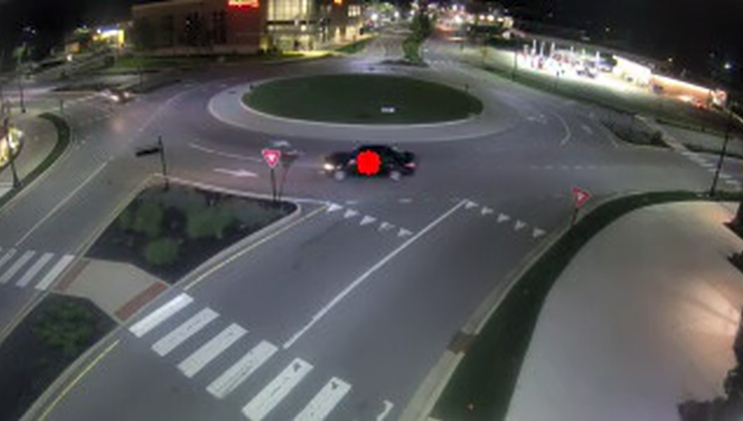
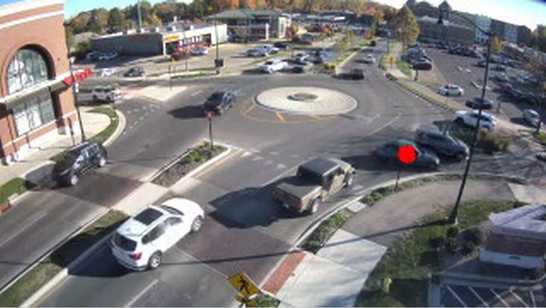
This dataset contains traffic anomalies from **static overhead cameras** (intersections/roundabouts).
It includes **32 anomaly categories** with a **relevance mapping** for severity-aware evaluation.
For each camera, we provide video frames with YOLOv8 detections, including 24 h of training footage and 48 h of test footage with **1027 anomaly annotations**.
Please see master thesis for details.
*This project was made possible by the city of Carmel, Indiana. Thanks to the mayor and the citizens of Carmel for supporting scientific research.
Special thanks go the city's IT department for technical support as well as helping to understand, how traffic in Carmel works :)
To find out more about Carmel look here: https://www.carmel.in.gov/*
## What’s inside
- **Three camera scenes** (each with `traindata` and `testdata`).
- **Frames** (320×180) as WebDataset `.tar` shards (`frames-xxxxx.tar`) plus a global `index.csv`.
- **Object detections** (YOLOv8) with tracking IDs and geo-coordinates in `object_detections.json`.
- **Anomaly annotations** in `anomaly-labels.csv` (test split only).
- **Label dictionary** in `event_labels.txt` and **relevance mapping** in `relevance_mapping.json`.
#### Anomaly labels
- `label ∈ {-1, 0, 1, …, 32}`
- `-1` = marks detection/tracking artifacts so they don’t bias evaluation (e.g., spurious box, ID switch)
- `1…32` = anomaly categories (see `event_labels.txt`)
- unlabeled trajectories are treated as normal (label `0`)
- **Relevance degrees** (0–4) for severity-aware evaluation in `relevance_mapping.json`. The category→relevance mapping is subjective and may be adapted to match different application priorities.
- `0`: FP/uninteresting
- `1`: rather uninteresting anomaly
- `2`: relevant anomaly
- `3`: high relevance
- `4`: critical relevance (dangerous behavior)
#### Example anomaly categories
- **Wrong-way driving** *(IDs: 22, 23)* — vehicle travels against permitted direction
- **Fast driving** *(ID: 11)* — reckless speeding relative to scene context
- **Traffic tie-up** *(ID: 16)* — blockage or standstill due to congestion/obstruction
- **Cutting off another vehicle** *(IDs: 18, 19)* — failing to yield / forcing an agent to brake
- **Broken-down vehicle** *(ID: 25)* — stationary/disabled vehicle on a public road.
- **Getting off the road** *(IDs: 28, 29)* — getting off the roadway / parking on sidewalk
Wrong-way driving (23)Cutting off (almost collision) (19)Parking on sidewalk (29)Broken-down vehicle moved by people (25)